Everything you need in a single system!
Leverage satellite insights and real-time soil data to cut fertilizer expenses, boost yields, and save time!Sign up for free
1. WhereWe use satellite data to detect inefficiencies and identify the most optimal test points in your fields
2. WhyOur drones land on the test points and perform soil diagnostics to identify the root causes of inefficiencies
3. HowWe generate precise, data-driven fertilizer application maps to help you resolve field inefficiencies
World's most advanced farm management platform
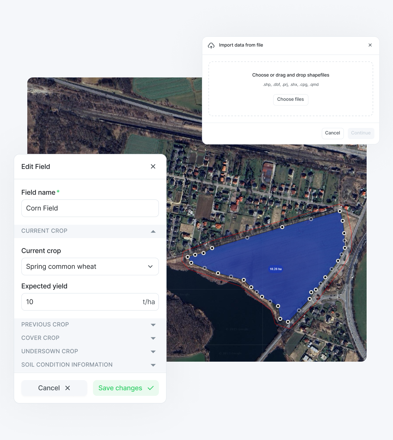
Field managementAdd fields in seconds by drawing on the map or uploading files - then organize by function
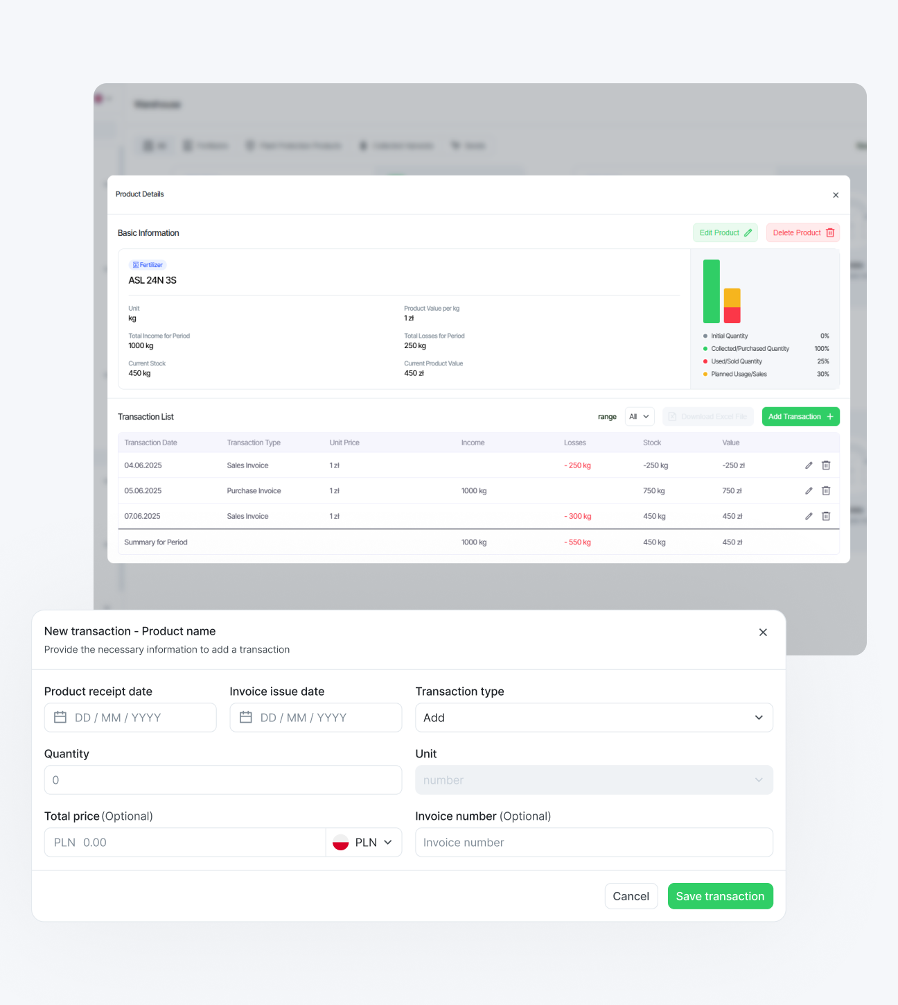
Inventory trackingLog an invoice or schedule a treatment - your inventory updates instantly, no extra steps
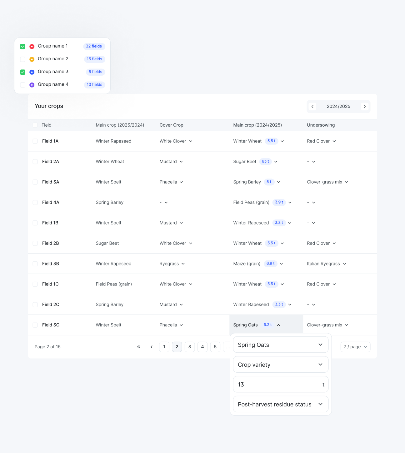
Crop rotation planningPlan rotations with main, cover, and catch crops to improve soil health and ensure productivity
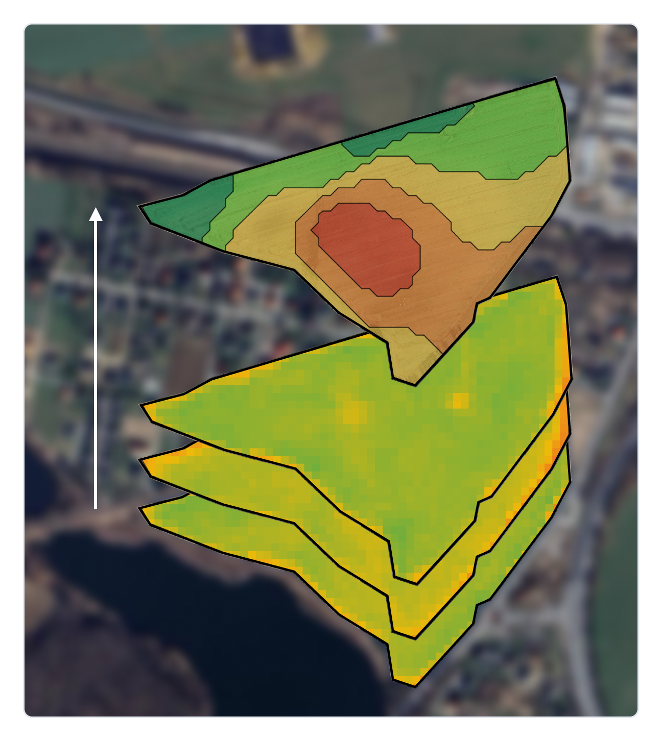
Satellite monitoringGet satellite updates every 3-5 days and use multi-season data to map stable productivity zones
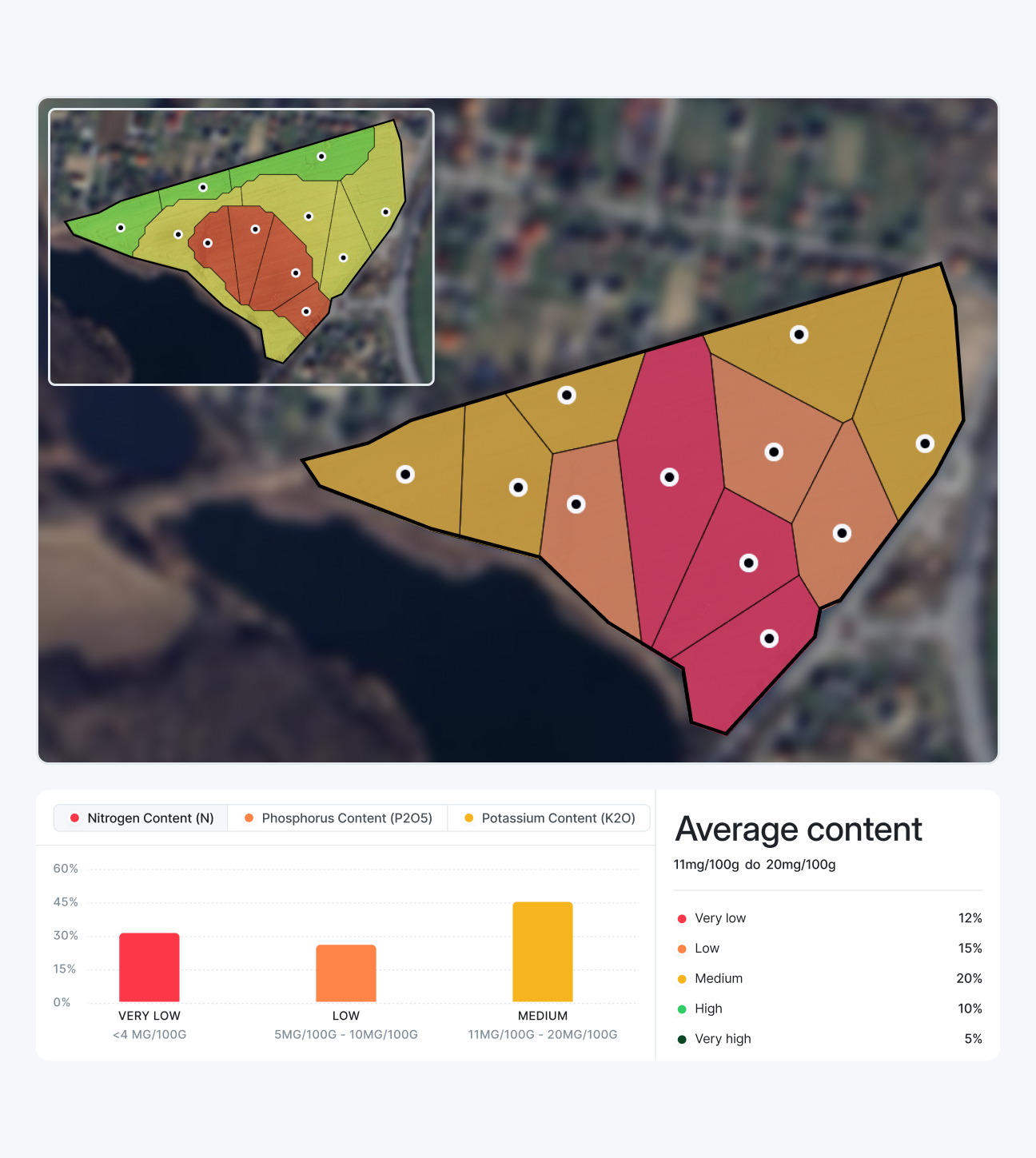
Soil condition analysisPinpoint optimal test zones with satellite data, then import, process and visualize lab results
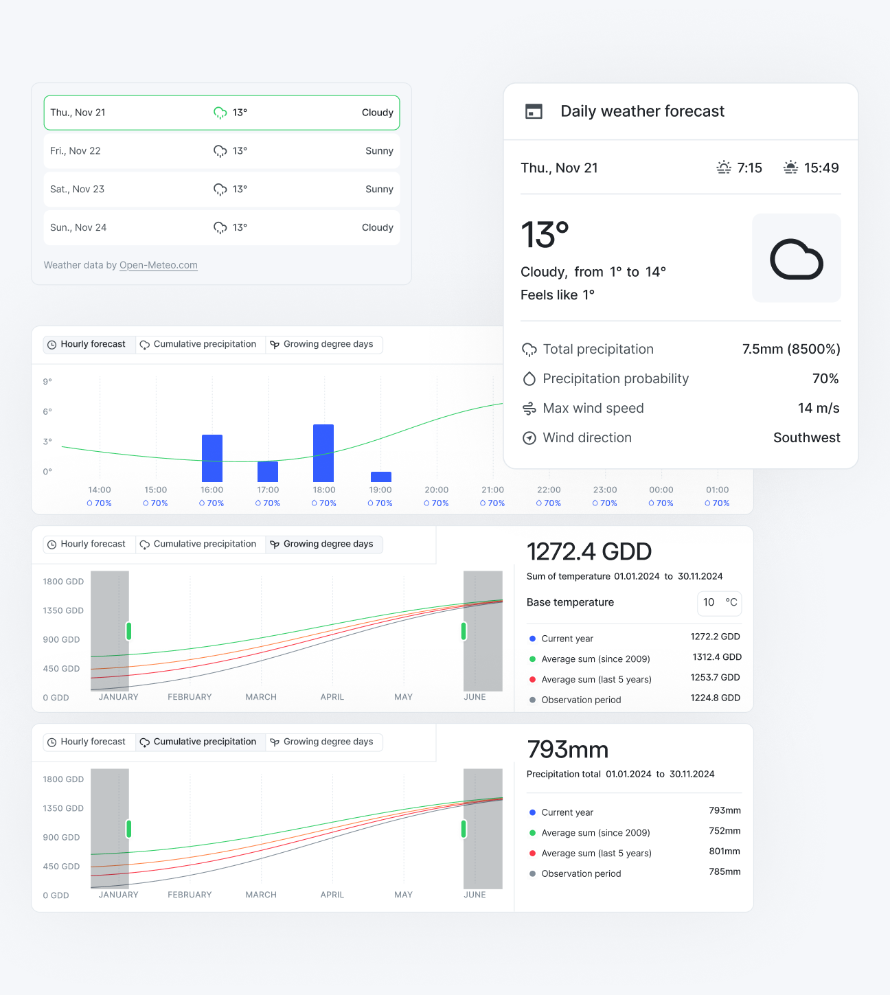
Weather monitoringAccess 7-day forecasts to time treatments and analyze historical rainfall and temperature data
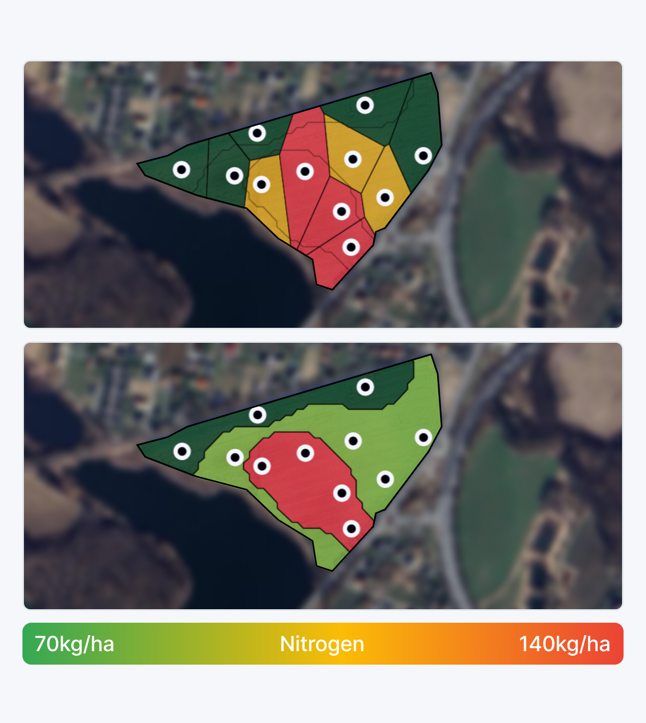
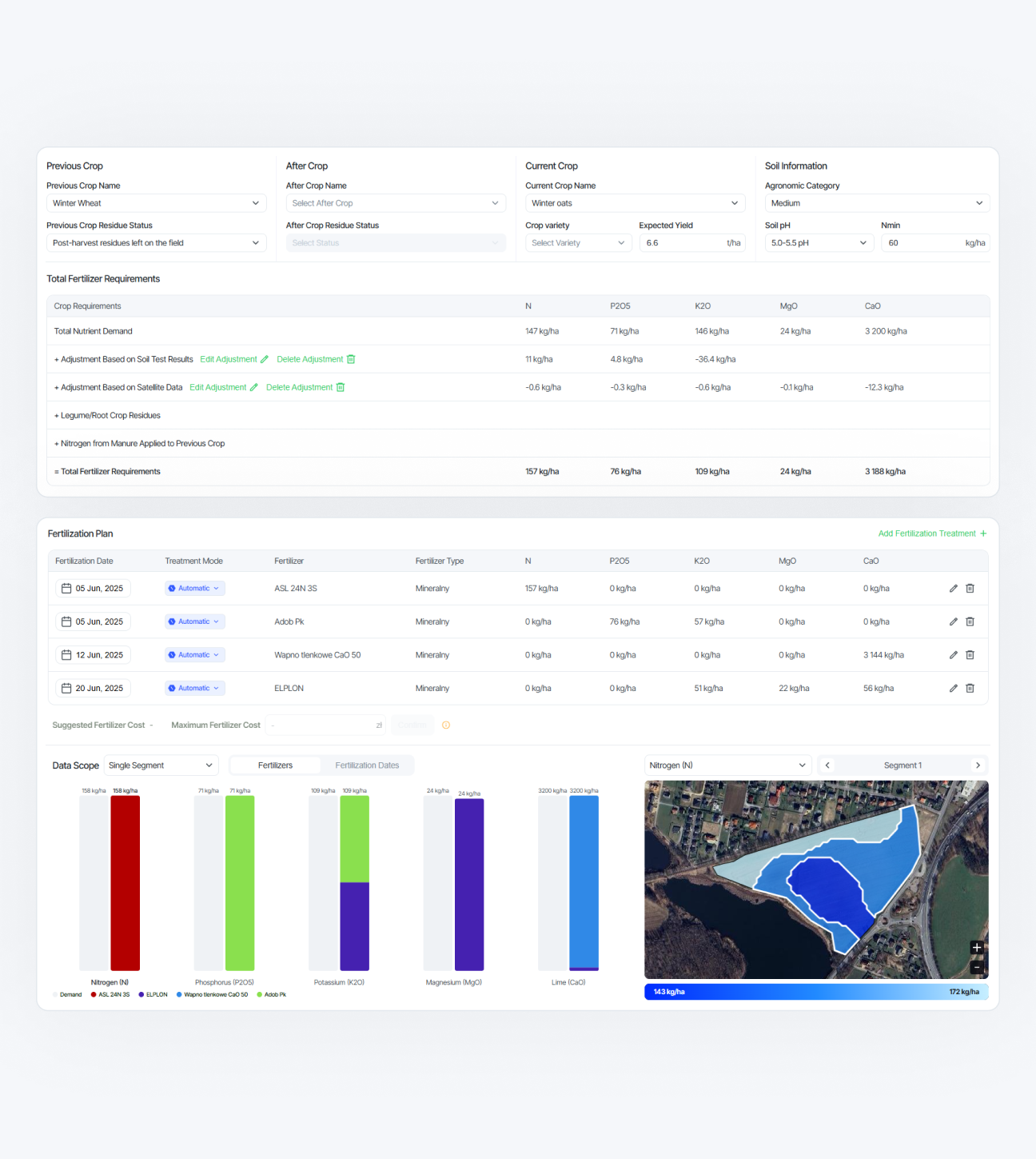
Precision fertilizingGenerate application maps based on soil, satellite, and crop data to boost yield and reduce waste
Treatment schedulingSchedule treatments at the optimal time using weather, crop stage, and field condition data
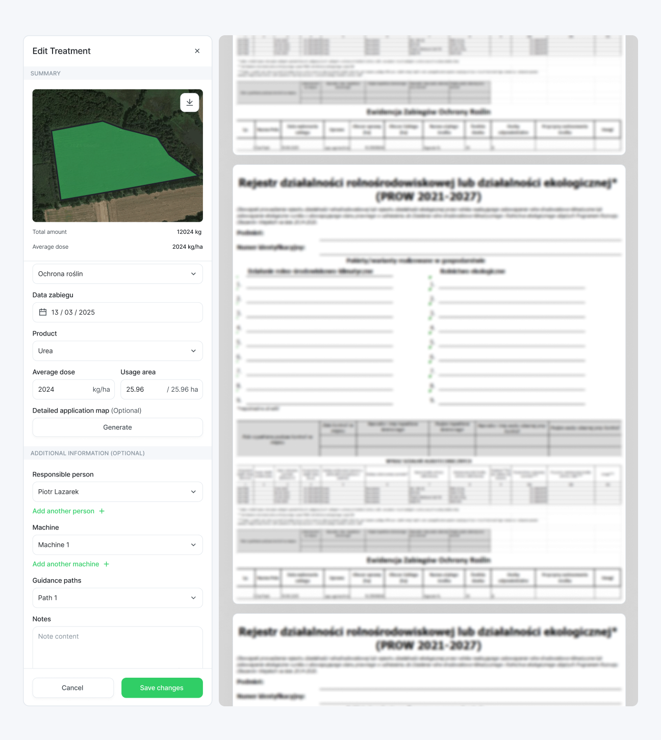
Compliant reportingAutomatically log all treatments and generate reports that meet regulatory requirements
World's first and only drone for real-time soil testing


A 3-step process todetect, diagnose, and fix inefficiencies
?
WHERE1
WHERE are the inefficiencies?We use satellite data to determine the most optimal test points
?
WHY2
WHY do they occur?We perform real-time soil condition tests with our drones
?
HOW3
HOW to fix them?We generate precise application maps for fertilizers
Recognized globally by world's leading universities,startup competitions, and public institutions


Our story told by world's leading media
Nirby named the best bootstrapped startup in Poland by Forbes26.06.2025 Nirby empowers farmers to maximize profits26.07.2023
 Nirby - a greener way to grow cropsFall/Winter 2024
 Using satellites, drones, and AI for more sustainable and efficient agriculture04.06.2025
 Polish farming-revolutionizing startup wins prestigious award19.04.2024
 Space technology at ground level: meet Nirby19.04.2024
 Polish agriculture startup Nirby wins 4 major awards!19.04.2024
 Nirby drone is a flying drilling platform and laboratory in one10.05.2024
 Nirby is an advanced soil health analysis and farm management system
 Most disruptive business school startup 202305.01.2024
 Technology to the rescue of farmers15.07.2024
 They put AI to work in the fields, now they're reaping the rewards18.04.2024
Nirby empowers farmers to maximize profitsNirby - a greener way to grow cropsUsing satellites, drones, and AI for more sustainable and efficient agriculturePolish farming-revolutionizing startup wins prestigious awardSpace technology at ground level: meet NirbyPolish agriculture startup Nirby wins 4 major awards!Nirby drone is a flying drilling platform and laboratory in oneNirby is an advanced soil health analysis and farm management systemMost disruptive business school startup 2023Technology to the rescue of farmersThey put AI to work in the fields, now they're reaping the rewardsLimited-time offer: get $100 worth of Nirby Premium for freeJoin today and get 1 year of Nirby Premium for up to 25 acres at no cost!Many features stay free forever, even after your trial ends.Sign up for free
Join our incredible team


Piotr
LazarekFounder & CEO
LazarekFounder & CEO
Jakub
JurzakHardware Engineering Lead
JurzakHardware Engineering Lead
Michal
DubrowskiFull-Stack Developer
DubrowskiFull-Stack Developer
Jakub
KowalFull-Stack Developer
KowalFull-Stack Developer
Pawel
NawaraProduct Designer
NawaraProduct Designer
Jakub
JedrzejewskiMechanical & Electrical Eng
JedrzejewskiMechanical & Electrical Eng
Dayan
ParkerHardware Intern
ParkerHardware Intern
Jakub
PolakSoftware Intern
PolakSoftware Intern
prof. Jeffrey
BabinMentor
BabinMentor
prof. Andrzej
BorusiewiczAdvisor
BorusiewiczAdvisor
Hardware Product Designer
We are hiring! Apply now
Sales Manager
We are hiring! Apply now
Marketing Manager
We are hiring! Apply now

Piotr LazarekFounder & CEO
Contact details piotr@nirby-solutions.com
 +48 662 928 224